|
The numbers of the grid are the 10 and 1 km UTM-values
Values of the horizontal lines from 3060-3084
Values of the vertical lines from 188-216
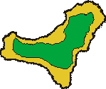
The map area compiles accordingly the UTM-values from 28RAR8860 to 28RBR1684.
Within El Hierro runs the boundary line between the UTM-zones 27 and 28. In official maps
usually the entire island is included in the 28-zone, hence the square 28RAR is applied also to the western part of El Hierro (instead of the square 27RYL).
The contour lines run along the 200 m-isohypses.
The application of the UTM-grid for botanical or faunistic issues is described by
Ibañez, M. & Alonso, M. R. 1990:
La proyección U.T.M.: Su aplicación al estudio de la fauna y flora canaria.
Homenaje al Prof. Dr. Telesforo Bravo I.: 453-470
|
